NOAA begins sunsetting process for raster and paper charts
Written by Marine Log Staff
NOAA logo
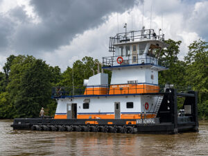
When the National Oceanic and Atmospheric Administration (NOAA) announced that it would be phasing out traditional paper nautical charts this year, coastal tug and passenger vessel crews were ready for the most part. The same can’t be said, necessarily, about the more customary inland towboat sector, although there is a solution for them.
NOAA says it will end production of the paper charts by January 2025, but will continue to provide users access to paper charts via the NOAA Custom Chart tool.
Traditional paper and raster charts are still updated on a weekly basis, with critical navigation changes that are released in the U.S. Coast Guard Local Notice to Mariners. However, other changes, such as data from new shoreline and bathymetric surveys, and other non-critical changes are no longer compiled onto traditional paper and raster charts.
Another option for both coastal and inland crews is the navigation software Rose Point ECS implemented by Rose Point Navigation Systems.
According to Joe Sluka, commercial marine sales director of Rose Point Navigation Systems, Rose Point ECS improves operational efficiency, situational awareness, and decision making with straightforward, uncluttered displays and controls that provide instant access to the information professional mariners and fleet operators need to navigate safely.
As a solution to the phasing out of paper and raster charts continues, we wanted to find out more about this software and how NOAA’s move will impact mariners here in the U.S.
Marine Log (ML): In 2019, both NOAA and AWO released comments on the use of paper charts, with NOAA announcing that they would begin phasing them out in favor of electronic charting and AWO saying they support that transition. Where are we today with this transition from paper to electronic charts?
Joe Sluka (JS): NOAA began the process of sunsetting both raster charts and paper charts last month, starting with the Lake Tahoe charts. It was reported to me that they have approximately 1,100 charts that will be phased out (at 250 per year) of both paper and Raster versions by the year 2025. They do not have a schedule that will be followed (at least not one they will share or publish) for what regions will be sunset and when. This makes it difficult for me as a manufacturer, as well as an end-user, as neither of us will know when a new region or set of charts has been affected.
In U.S. waters, commercial vessels in NOAA charted waters are being encouraged by NOAA to transition to Electronic Vector Charts. NVIC 01-16 governs the paperless carriage requirements for vessels depending on where they transit.
ML: Despite encouraging the industry to move to electronic charting, NOAA says that it will still provide access to paper charts. Why does there seem to still be a preference in paper charting in some areas of maritime?
JS: NOAA announced an online tool that will make paper available but the page suggests the on-demand charts will not initially meet carriage requirements. Some fleets have chosen to stay with paper because they are comfortable and some because of cost. The U.S. Coast Guard believes that if this print on-demand moves forward, the charts will likely expire every six months making the cost less of a factor.
ML: Rose Point Navigation has a solution for those in the commercial shipping industry who wish to move over to electronic charting. Can you tell us more about that?
JS: NVIC 01-16 requires Electronic Charting Systems to meet certain requirements in order to conform. Rose Point ECS conforms to the requirements set forth in the document. There are hardware requirements for certain areas of transit spelled out in the NVIC. Rose Point ECS has solutions for each of these transit areas and meets the requirements in this document and can help fleets determine what hardware they need depending on their transit area.
ML: Are you seeing many coastal and inland shippers move from paper to electronic charts at this time? There are several major coastal fleets that have already made a full transition to paperless transit.
JS: There are several other major coastal fleets that have started the budgeting process for the hardware for this transition. The inland paperless carriage requirements are less stringent from a hardware standpoint. Most of the inland fleets of the nation already have Rose Point ECS software and therefore can become paperless operators with some policy changes and minor hardware considerations. The U.S. Corps of Engineers is the responsible charting authority for the Western Rivers from approximately Mile 236 of the Lower Mississippi River. The NOAA sunsetting program will not affect fleets that operate above Mile 236 exclusively.
Categories: Inland, Inland and Coastal