On February 13, 2015, El Faro successfully completed the American Bureau of Shipping (ABS) class and statutory surveys, meeting all rules and regulations as applicable. All deficiencies identified were rectified prior to completion of the surveys. None of the deficiencies were associated with El Faro’s main propulsion systems.
The annual inspection of El Faro, required by the United States Coast Guard (USCG), was completed by qualified USCG inspectors in San Juan, Puerto Rico, on March 6, 2015.
In June 2015, a qualified ABS surveyor examined and tested the main, auxiliary and emergency systems as part of the continuous machinery survey program and found them to be satisfactory.
TOTE told investigators that El Faro was scheduled to be removed from the route between Jacksonville and San Juan and redeployed to the U.S. West Coast where it would operate between Washington State and Alaska. In August, in order to prepare for this operational change, TOTE began to make modifications to the vessel while underway under the supervision of an additional chief engineer. Work on these modifications was performed by welders and machinists over many voyages, including during the accident voyage.
On September 11, 2015, TOTE received permission from the Coast Guard to shut down one of the ship’s two boilers so it could be inspected by an independent boiler service company during a voyage between San Juan and Jacksonville. As a result of the inspection, the boiler service company recommended service to both boilers during an upcoming drydock period that had already been scheduled for November 6, 2015. The boiler was returned to service following the inspection.
Interviews of relief crew and company management indicated that onboard safety drills were consistently conducted on a weekly basis. These included lifeboat drills for all crewmembers to ensure that all on board understood their responsibilities in an emergency.
Investigators interviewed two pilots that had guided El Faro in and out of the Port of Jacksonville; both reported that the vessel handled similarly to other vessels of its size and type.
The vessel’s terminal manager reported that El Faro met stability criteria when it left Jacksonville.The company’s procedures called for some cargo on the ship to be “double lashed” regardless of the weather expected to be encountered during the voyage. The vessel stevedores reported that prior to El Faro’s departure on the accident voyage, the cargo was secured in accordance with those procedures.
Before El Faro departed Jacksonville, Tropical Storm Joaquin was predicted to become a hurricane and a marine hurricane warning was issued by the National Hurricane Center’s Advisory #8 at 5:00 pm EDT on Sept. 29.
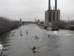
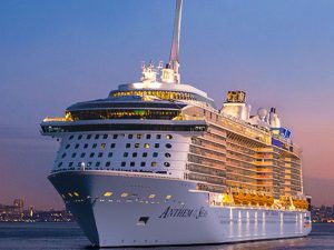
At about 8:15 pm EDT on Sept. 29, El Faro departed Jacksonville, Fla., for San Juan, Puerto Rico.
At 1:12 pm EDT on Sept. 30, the captain emailed a company safety official that he intended to take a route south of the predicted path of the hurricane and would pass about 65 miles from its center.
In an advisory issued at 2:00 am EDT on Oct. 1, the National Hurricane Center predicted seas of 30 feet with sustained winds of 64 knots (74 mph), increasing to 105 knots (121 mph) as the El Faro approached the wall of the eye of the hurricane.
In a recorded satellite phone call to the company’s emergency call center at 7:00 am EDT, the captain told the call center operator that he had a marine emergency. He reported that there was a hull breach, a scuttle had blown open, and that there was water in hold number 3. He also said that the ship had lost its main propulsion unit and the engineers could not get it going. The operator then connected the captain with the Designated Person Ashore (DPA). The DPA told investigators that the captain had communicated similar information to him that was provided to the call center operator, and also that the captain had estimated the height of the seas that El Faro was encountering to be 10 to 12 feet.
The USCG received electronic distress alerts from three separate sources on El Faro: the Ship’s Security Alert System (SSAS), the Inmarsat-C Alert, and the Emergency Position Indicating Radio Beacon (EPIRB).
According to electronic alert system data sent by the vessel at 7:17 am EDT on Oct. 1, its last reported position was about 20 miles from the edge of the eye of the hurricane.
The USCG did not have direct voice communications with El Faro, only electronic distress alerts.
The NTSB investigators that traveled to Florida have returned to continue work on the investigation from NTSB headquarters in Washington.
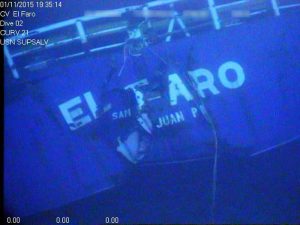
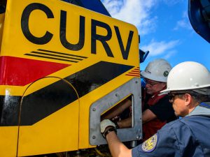
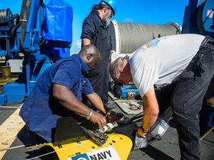
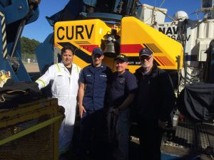
The NTSB contracted with the U.S. Navy to locate the ship, document the wreckage on the sea floor and recover the voyage data recorder.
The USNS Apache, a fleet ocean tug, was outfitted with specialized equipment for this mission, and departed Little Creek, Virginia, at about 4:30 pm EDT on October 19. In addition to the Navy crew, the NTSB investigator-in-Charge, Tom Roth-Roffy, is on Apache with representatives from the USCG, TOTE and ABS, all parties to the NTSB investigation.
The Apache is estimated to arrive at the last known position of El Faro on Saturday, October 24, to begin the search for the ship and to recover the voyage data recorder. Once the search operation begins, it is expected to take at least two weeks.
The length of the operation will depend on the circumstances encountered.Updates on the search for the vessel and the accident investigation will be issued as circumstances warrant.